
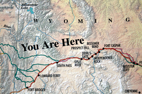
Who doesn’t love a clear label? And who doesn’t love a map that says “You are here?” Especially when you’re lost and all.
This is a great picture showing where exactly I’m herding my pioneers in Undesirable. Between South Pass and Lombard Ferry, there’s a whole lot of nothing. Well, sagebrush and gravel, but no water. Even if they take one of the green routes to the Green River, there are two small rivers that might have water for the people and animals. Heavy on the might, because even in July, the spring thaw had just begun in the higher elevations. Snowfall was a real possibility in the high desert. Days there are hot and the nights freezing cold.
The average distance traveled per day for people so far had been anywhere from 15 to 20 miles a day. To get through this stretch of dry, people went as far as 30 to 45 miles in a day. By the time they reached South Pass, their shoes and clothes would be worn to nearly nothing.
There’s tons more information at Greater South Pass Historic Landscape alliance, the site where I found this picture. Click on the photo to go visit them and learn more about their work. For more information on my work, try one of the menu items above, particularly the Oregon Trail tab.
